
Wuyitak Fm
Type Locality and Naming
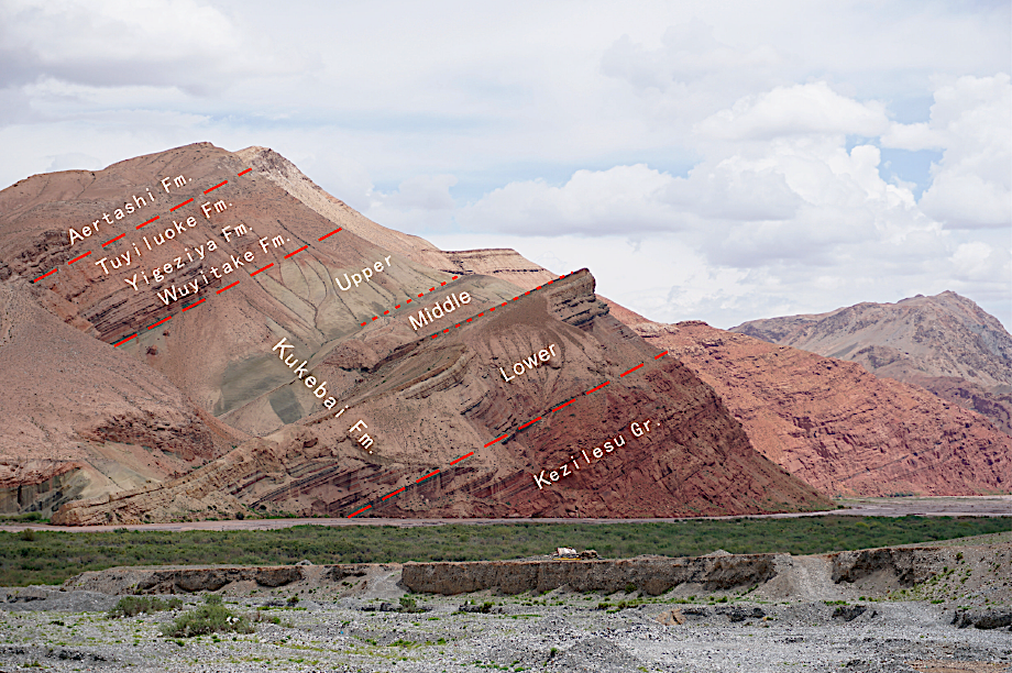
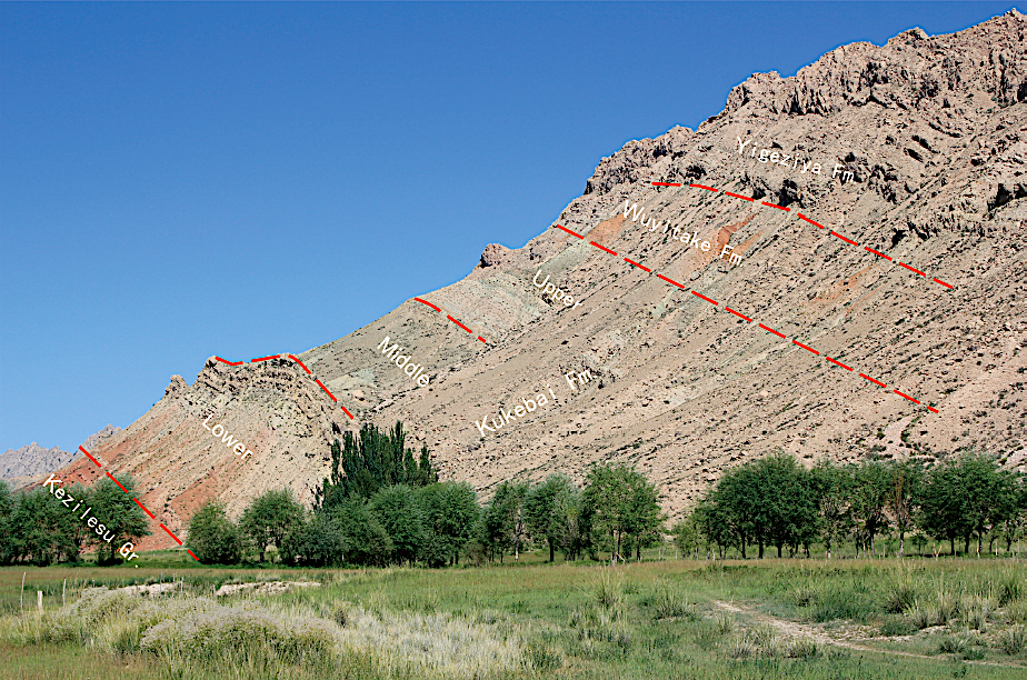
Western Tarim Basin. The Wuyitak Formation was erected by the No.107 geological team under the Xinjiang Petroleum Administration in 1976. The section for the designation is at Wuyitak about 50 km southwest of the Akto County of Xinjiang.
Lithology and Thickness
The Wuyitak Formation is represented by a set of variegated mudstone and limestone, which is divided into three parts. Lower part is built up by light gray and green gypsum mudstone interbedded with brown red mudstone. Middle part is gray green mudstone with gray thick-bedded limestone. Upper part is red sandy mudstone. It is 110 m thick.
Outcrop photographs -- see Kukebai Fm.
Relationships and Distribution
Lower contact
The conformable base of the formation marked by variegated gypsum mudstone is distinguished from gray limestone of the underlying Kukebai Fm.
Upper contact
The conformable top marked by red sandy mudstone is bounded by light red limestone of the overlying Yigeziya Fm.
Regional extent
The present formation occurs in Wulukeqiati, Bashibulake, Kukebai and Kuzigongsu along the piedmont of the Tianshan Mountain. It is exposed discontinuously at the foot of the west Kunlun Mountain and also occurs in Artashi, Qimeigen, Tamu, Tuyiluoke and Yigeziya north of the Yarkant river in Yingisar. To the north of the Yarkant river, it is dominated by sandstone, limestone and gypsum, which is red in the upper part and variegated in the lower part, ranging from 34 to 105 m in thickness. To the south of the Yarkant river, it varies considerably in lithology, which is difficult to distinguish from the underlying Kukebai Formation.
GeoJSON
Fossils
In Akcheyi, it yields Foraminifera fauna Pararotalia-Cibicudina-Qinqueloculina; in Qiemo, ostracods Centrocyhere circincostata; in Wulukeqiati, the Palaeohystrichophora infusorioides-Spiniferites ramosus assemblage and the Senengalosporites minor-Crenwellia striata assemblage.
Age
Depositional setting
It belongs to neritic facies.
Additional Information